Using lightning maps how fast could drones respond to fires caused by dry lightning ?
https://www.lightningmaps.org/?lang=en#m=oss;r=0;t=3;s=0;o=0;b=;n=0;y=-28.7456;x=142.7148;z=5;ts=0;
Using lightning maps how fast could drones respond to fires caused by dry lightning ?
https://www.lightningmaps.org/?lang=en#m=oss;r=0;t=3;s=0;o=0;b=;n=0;y=-28.7456;x=142.7148;z=5;ts=0;
Tau.Neutrino said:
Using lightning maps how fast could drones respond to fires caused by dry lightning ?
https://www.lightningmaps.org/?lang=en#m=oss;r=0;t=3;s=0;o=0;b=;n=0;y=-28.7456;x=142.7148;z=5;ts=0;
I like that question.
Wind speed would be a factor. The main limitation would be how fast Storm chasers could get there.
Could a network of AI computers using infrared and optical sensors be built to monitor bush fires and forest fires?
Sensors placed on the highest mountains and hilltops
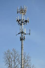
placed on existing cell radio towers

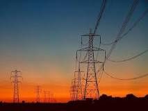
and on existing high voltage power lines

Internet of things (IoT) Fire spotters
Fit the same infrared and optical sensors and a AI fire spotting chip to high altitude drones deployed on total fire ban days or high or as conditions dictate.
Plantation Tree growers could benefit from infrared optical fire sensors, solar/battery?comm devices.
And crown bush / forests etc
Tau.Neutrino said:
Fit the same infrared and optical sensors and a AI fire spotting chip to high altitude drones deployed on total fire ban days or high or as conditions dictate.
I agree. Not too high or they’re inside the thunder cloud. They’d better be rainproof and hail-proof as well.
The base of a thunder cloud can be so low that it’s below ground level on hilly terrain. Say 150 metres up.
If the cloudbase is higher, though, more like 6,000 metres up, then flying a drone under it would be much easier.
Would a 60 metre high periscope on top of a fire truck help?
“Fire spotting drone. NASA’s Langley Research Center in Hampton, Virginia, has signed a one-year agreement with the Department of the Interior’s U.S. Fish and Wildlife Service to test small flying drones as a way to check for brush or forest fires at the Great Dismal Swamp National Wildlife Refuge on the Virginia-North Carolina border.”
https://www.flickr.com/photos/nasa_langley/sets/72157648777690822/
“Fire spotting plane. The NSW Rural Fire Service will again be using aircraft to look out for bushfires following lightning strike across the state this summer. This week saw a major band of storms move through the state and the RFS sent its spotting planes into the air to detect ignitions.”
mollwollfumble said:
Would a 60 metre high periscope on top of a fire truck help?
You wouldn’t want to need the truck for fire fighting duties…
buffy said:
mollwollfumble said:
Would a 60 metre high periscope on top of a fire truck help?
You wouldn’t want to need the truck for fire fighting duties…
How else is it going to find the fire?