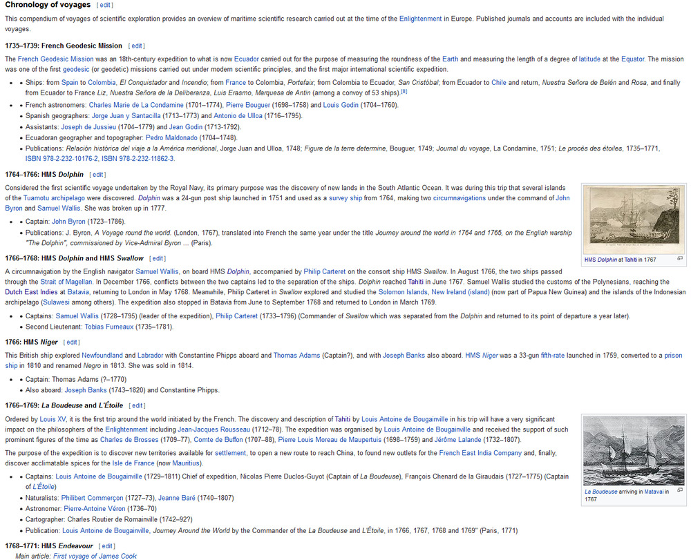
mollwollfumble said:
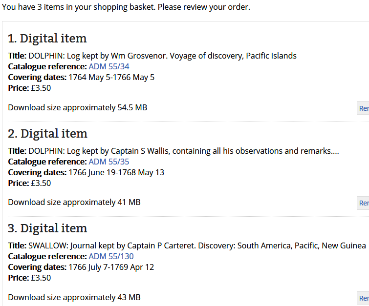
Reading the diary for The Swallow first, because it’s the least known.
Difficult to read, not so much because of the poorness or antiquity of the writing, but because of fading.
22 Jul 1766, first boarded the Swallow in Chatham.
10 Aug 1766, met the Dolphin at Portsmouth.
8 Sep 1766, at the island of Madeira.
24 Sep 1766, at Porta Priya Bay (wherever the hell that is)
29 Sep 1766, passing St Jago (is this Santiago? can’t be)
8 Dec 1766, passing Penguin Island
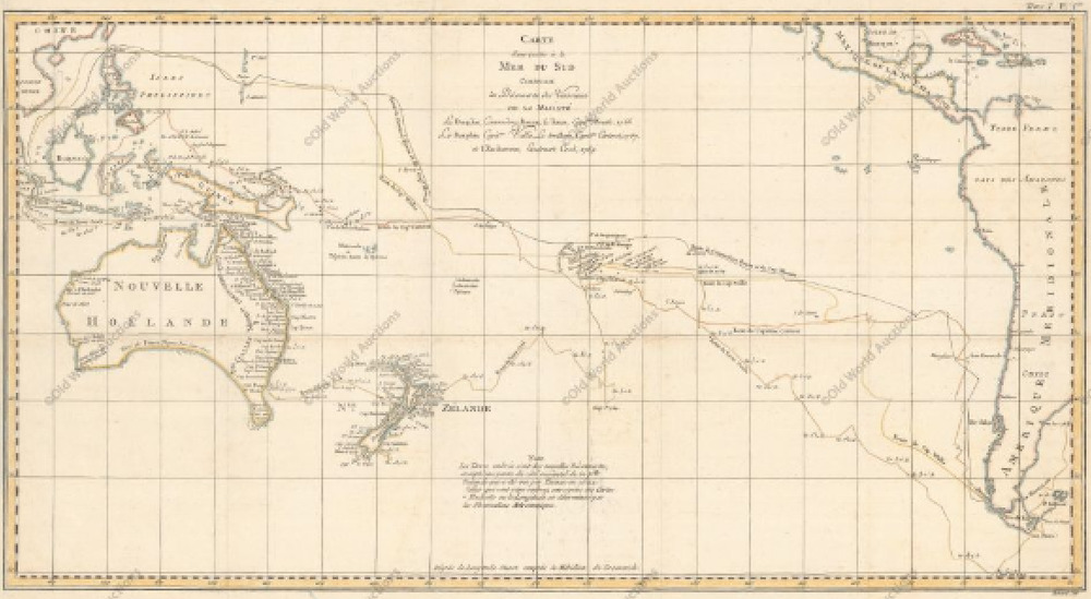
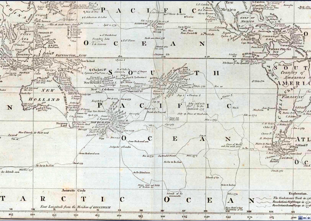
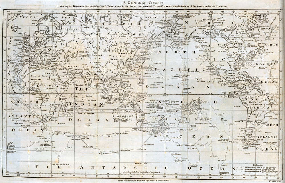
16 Dec 1766, passing Cape Fair Weather (latitude 51˚37’S, longitude 69:06W from London). That’s just before the Straits of Magellan (latitude 52˚17’S).
19 Dec 1766, at Possession Bay
27 Dec 1766 to 17 Jan 1767, moored at Port Famine Bay (half way through the Straits of Magellan)
23 Jan to 27 Jan 1767, moored at Port Gallant Harbour
…
Lots of unfamiliar place names, aha, found something.
10 May 1767, Juan Fernando (I bet that’s Juan Fernandez Islands, 670 km off the coast of Chile, Latitude 33˚S)
Found this on the web about the Swallow’s journey.
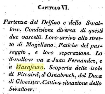
Translates partly as “Bad situation of the Swallow” and “Discovery” of three islands.
Finally getting some latitudes and longitudes.
25 May 1767, Latitude 32˚5’S, Longitude 0˚46’E, (so sailing due west from Juan Fernandez Islands, compare Sydney at 34˚S).
15 Jun 1767, Latitude 27˚47’S, Longitude 20˚0’W.
Hold on, those longitudes can’t be right
12 Aug 1767, Latitude
13 Aug 1767, to be continued, not quite rivetting reading
Only one place mentioned before the Carteret Islands.
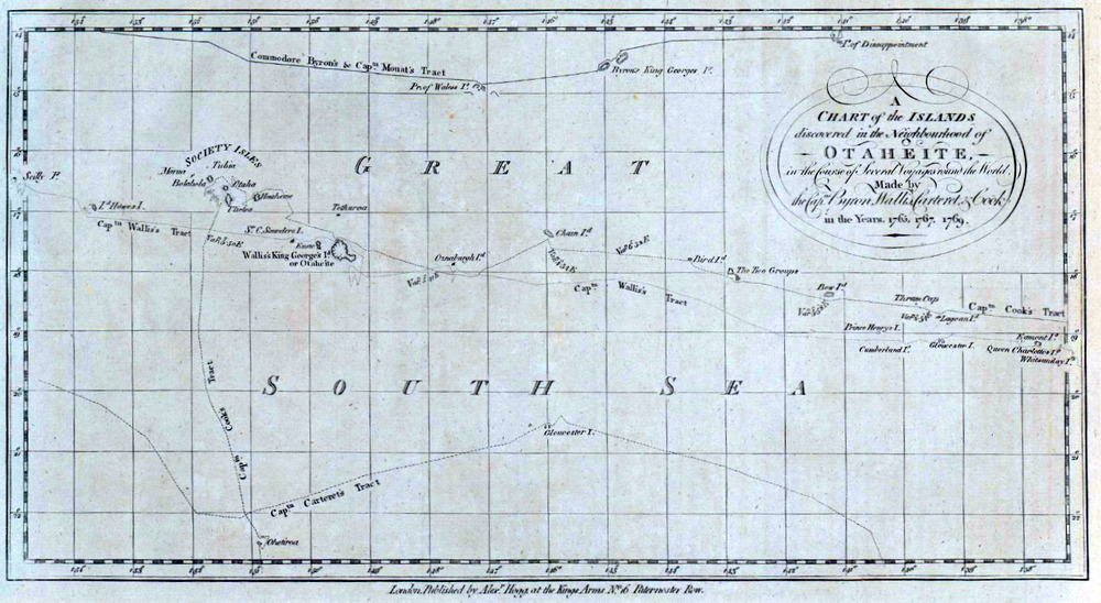
“The Carteret Islands (also known as Carteret Atoll, Tulun or Kilinailau Islands/Atoll) are Papua New Guinea islands located 86 km (53 mi) north-east of Bougainville in the South Pacific. The atoll has a scattering of low-lying islands called Han, Jangain, Yesila, Yolasa and Piul, in a horseshoe shape stretching 30 km (19 mi) in north-south direction, with a total land area of 0.6 square kilometres (0.2 sq mi) and a maximum elevation of 1.5 metres (4 ft 11.1 in) above sea level. The group is made up of islands collectively named after the British navigator Philip Carteret, who was the first European to discover them, arriving in the sloop Swallow in 1767.” 4°45′S 155°24′E
10 Sep 1767, Latitude 4˚14’S Longitude 0:55W. Longitudes still make no sense.
“New Hanover Island, also called Lavongai, is a large volcanic island in the New Ireland Province. This region is part of the Bismarck Archipelago of Papua New Guinea and lies at 2.5°S 150.25°E”.
2 Nov 1767, Mindanao in the Philippines.
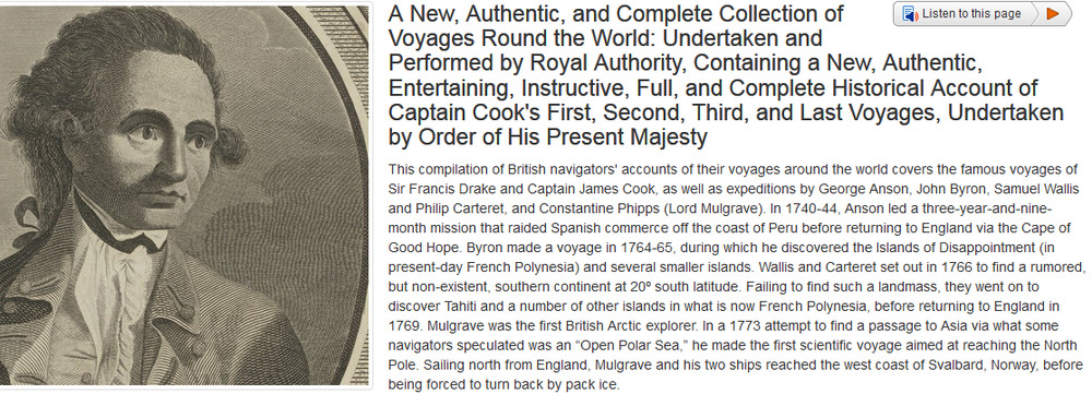
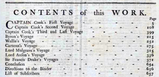
“Carteret’s Voyage Round the World, 1766-1769, Volume 1” Google ebook – much more readable, too expensive. But we know that, unlike Cook, he did have big problems with scurvy.
14 Dec 1767, The Celebes
16 Dec 1767, Macassar
21 Dec 1767 to 21 May 1768 , Moored at Bonthain Bay, Celebes. Why five whole months? Probably make interesting reading.
3 Jun 1768, Batavia
etc. Hung around “Coopers island”, wherever that is, probably in Indonesia, until back to serious sea on 30 Sep 1768.
28 Nov 1768 to 6 Jan 1768, Table Bay, Cape of Good Hope
21 Jan 1769, Saint Helena
31 Jan 1769, Ascension Island
St Michael Island
25 Mar 1769, Portsmouth (home)
By then, the Endeavour with Cook would have been long gone. He was in Tahiti by 3 Jun.