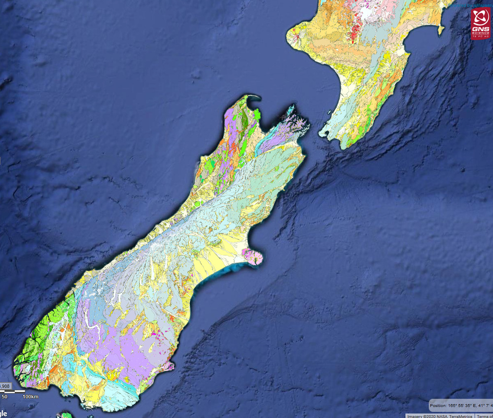
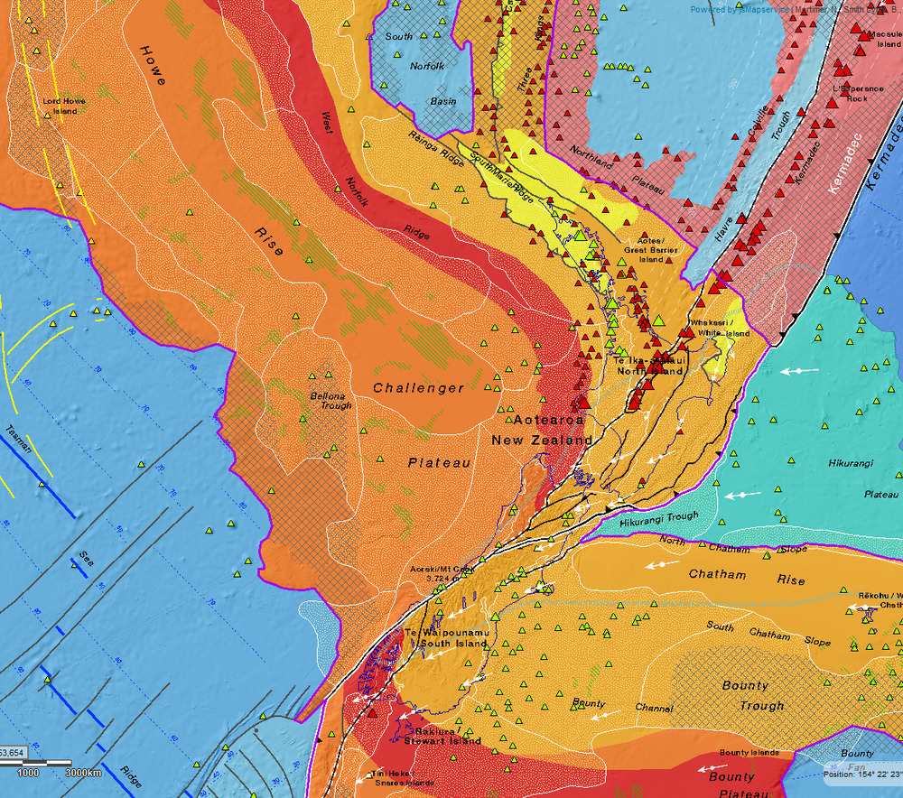
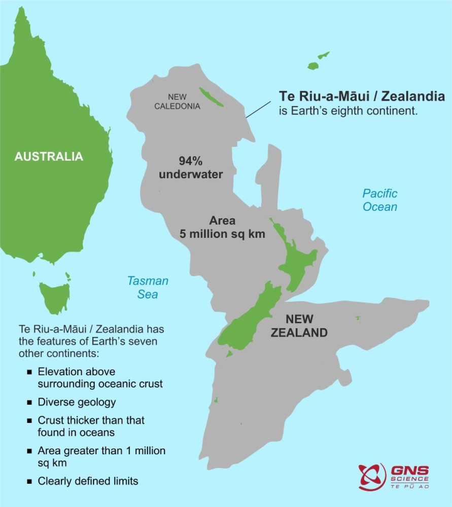
Newly released maps of Zealandia, a massive sunken landmass many have argued should be classified as Earth’s eighth continent, are revealing the topography of this underwater land in unprecedented detail. The new trove of data comes from New Zealand research institute GNS Science, which has released two new maps alongside an interactive website designed to give people novel ways to explore the complex geoscience data.
“Users can zoom and pan around different thematic geoscience webmaps of the region,” explains Vaughn Stagpoole, program leader on the development of the new website. “They can readily view and interrogate the maps and turn layers on or off. They can also query features in the layers and generate custom maps of their own.”
“We’ve made these maps to provide an accurate, complete and up-to-date picture of the geology of the New Zealand and southwest Pacific area – better than we have had before,” explains geologist Nick Mortimer, lead author on the new maps. “Their value is that they provide a fresh context in which to explain and understand the setting of New Zealand’s volcanoes, plate boundary and sedimentary basins.”
https://newatlas.com/science/ancient-submerged-continent-zealandia-new-interactive-maps/