Seems that the minimum has been reached, or very near to it, barring some unforeseen late September gusts. Pulses of warm air in early September pushed the melt front to within 400 km of the pole.
—-
September 16, 2020
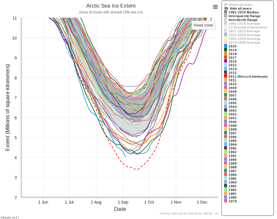
In the first week of September, sea ice extent took a sharp downward turn, exceeding the pace of decline for any previous year during that period, and placing the 2020 sea ice minimum firmly as second lowest—after 2012—in the 42-year continuous satellite record. Pulses of warm air from north-central Siberia are responsible for the late downward trend. Sea ice decline has slowed in the past few days, and the annual minimum is imminent.
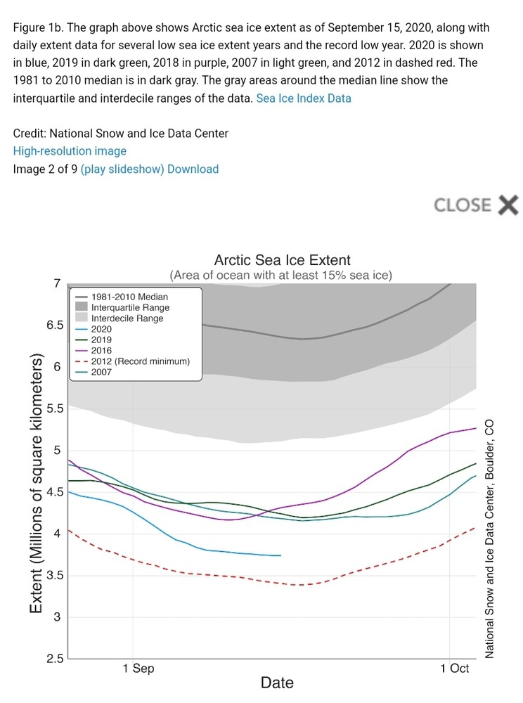
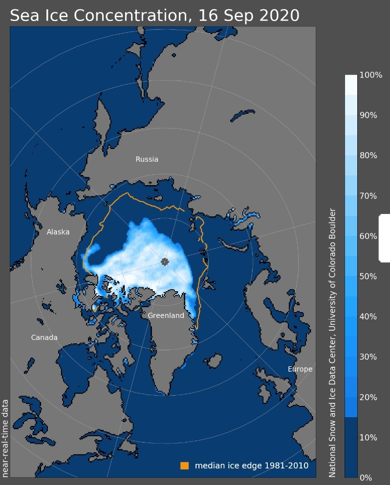
Sea ice extent stood at 3.74 million square kilometers (1.44 million square miles) on September 15, already well below 2007, 2016, and 2019 and within 400,000 square kilometers (154,400 square miles) of the record low extent set in 2012 (Figure 1a). Sea ice extent has dropped below 4 million square kilometers (1.54 million square miles) only once before, in 2012 (Figure 1b). Between August 31 and September 5, 2020, sea ice extent decreased by an average of 79,800 square kilometers (30,800 square miles) per day. This is a greater loss rate than any other year for these six days in the sea ice record. Ice retreat during this period was along the ice front in the northern Barents, Kara, and Laptev seas. A remaining tail of multiyear ice extends into the southern Beaufort Sea north of the Mackenzie River Delta and the Alaskan North Slope. North of Scandinavia and Russia, a very broad sea-ice-free area exists with the ice edge lying near 85 degrees N, far to the north of Svalbard, Franz Josef Land, and Severnaya Zemlya (Northern Land) (Figure 1c). The sharply defined ice edge in this area, between about 0 degrees and 100 degrees longitude, indicates strong compaction of the ice by winds coming from the south and is the furthest north the ice edge has been in this location over the satellite data record (Figure 1d).