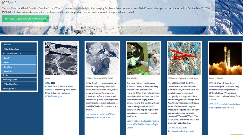
Orbital inclination provides data for up to 88 degrees north and south.
That’s good enough. In fact pretty close to perfect. There are some mountains between 87 and 88 degrees south but none further south than 88 degrees.
Where did this jpeg come from? It’s a good resolution up to and not beyond 88 degrees south. REMA = reference elevation model of Antarctica.
From 13 Sep 2018 http://www.sci-news.com/othersciences/geography/high-resolution-map-antarctica-06404.html
“Called the Reference Elevation Model of Antarctica (REMA), the map has a resolution of 26 feet (8 m). This means that researchers now know the height of every mountain and all the ice in all of Antarctica within a few feet. Up until now, we’ve had a better map of Mars than we’ve had of Antarctica. Now it is the best-mapped continent on Earth. The REMA map provides unprecedented detail that will help scientists measure the impact of climate change over time.”
“The project began with images taken from a constellation of polar-orbiting satellites about 250-435 miles (400-700 km) in space. These satellites have been collecting imagery for more than six years to get collect enough imagery for this project. The team developed the software to process the images and put the maps together over the last five years with computer processing help from the Blue Waters supercomputer. The scientists processed millions of images to create the high-resolution topographic map. This is just the first step. We never dreamed we’d be able to process this volume of data with such accuracy. Now, we’ll now be able to repeat this process one and a half times every year so we can see the change over time.”
https://www.pgc.umn.edu/projects/the-reference-elevation-model-of-antarctica-release-1/
“REMA is constructed from hundreds of thousands of individual stereoscopic Digital Elevation Models (DEM) extracted from pairs of submeter resolution DigitalGlobe satellite imagery licensed by the National Geospatial-Intelligence Agency, including data from WorldView-1, WorldView-2, and WorldView-3 acquired between 2009 and 2017, with most collected in 2015 and 2016.”
What are those satellites? The WorldView satellites are operated by a civilian company. https://en.wikipedia.org/wiki/DigitalGlobe So data may be expensive to obtain directly from that company.
https://docs.google.com/document/d/1XlSk1wK_KHaYSdKVp3Fq_tJA8gh0v2YqNi8OANj7_IQ/view
“As with any optical imagery-derived elevation product, void areas or artifacts may appear where cloud cover, shadows, and unfrozen water bodies exist in the source imagery, or in regions of low radiometric contrast where pixel correlation cannot be resolved by the software.”
I’ve struck those limitations before. They are extremely severe for snow fields because son fileds are usually featureless so no pixel correlation so no data. I’m hoping that ICESat-2 can overcome those limitations.
“Data is stored and distributed in 32 bit GeoTIFF file format with floating point elevation values.”
Whistles through teeth, I think I can handle that.
“Mosaic files are distributed at 8 meter resolution.”
Wow. Got a supercomputer for storing that data?
“All strip and tiled mosaic REMA deliverables are projected to WGS84 Antarctic Polar Stereographic projection and referenced to WGS84 horizontal datum (EPSG:3031). Vertical reference is height above the WGS84 ellipsoid. Elevation unit of measure is meters.
I wouldn’t want it any other way.
Head to http://cdn.sci-news.com/images/enlarge5/image_6404e-Reference-Elevation-Model-Antarctica.jpg for a higher resolution on the image below.