Michael V said:
Oooooh! Potential for lateral collapse of this volcano.
__________________________________________________
Cumbre Vieja Volcano — Potential collapse and tsunami at La Palma, Canary Islands
Steven N. Ward: Institute of Geophysics and Planetary Physics, University of California, Santa Cruz California, USA
Simon Day: Benfield Greig Hazard Research Centre, Department of Geological Sciences, University College, London, UK
Abstract.
Geological evidence suggests that during a future eruption, Cumbre Vieja Volcano on the Island of La Palma may experience a catastrophic failure of its west flank, dropping 150 to 500 km3 of rock into the sea. Using a geologically reasonable estimate of landslide motion, we model tsunami waves produced by such a collapse. Waves generated by the run-out of a 500 km3 (150 km3) slide block at 100 m/s could transit the entire Atlantic Basin and arrive on the coasts of the Americas with 10-25 m (3-8 m) height.
——————————————————————————————————————————————————————————————————-
https://websites.pmc.ucsc.edu/~ward/papers/La_Palma_grl.pdf
> Cumbre Vieja Volcano on the Island of La Palma may experience a catastrophic failure of its west flank
West flank! I hadn’t thought of that.
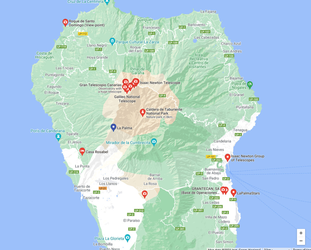
I was looking at the north flank. The north flank, where the observatories are, is extremely steep and unstable. But relatively local with a slip area no more than one square km.
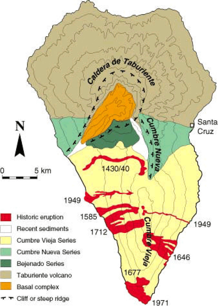
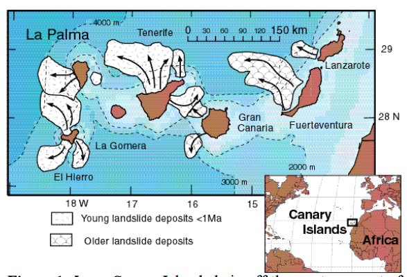
West flank, though, is much less steep. Any land-slip there would have to be larger than one square km. They are suggesting near 100 square km. I, personally, think the west flank is not steep enough for that yet. The volcano cone would have to increase in height over several thousand years first. Fingers crossed. The west flank is the most heavily populated flank.
Looking at the topography of La Palma I can see the boundaries of where the west flank collapsed last time. Yes, about 100 square km. It seems likely that the last collapse removed enough overburden to spark the high activity seen over the last few centuries. The next large collapse will probably not be in the same direction as the last one.
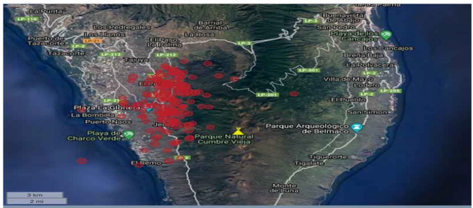
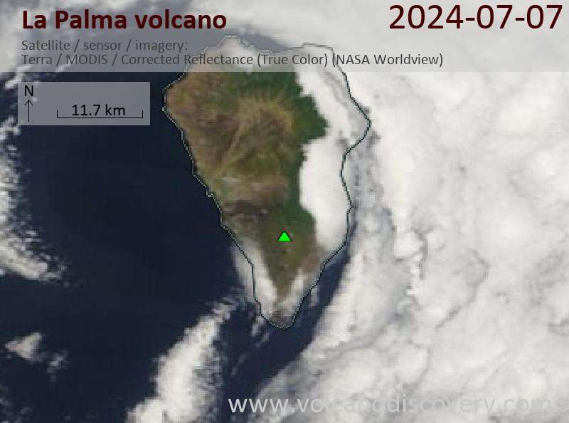
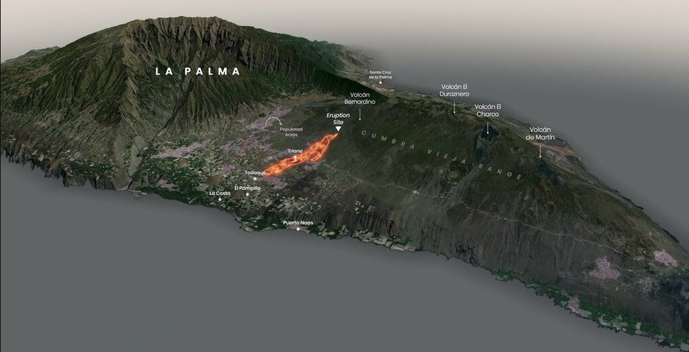
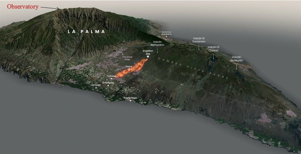
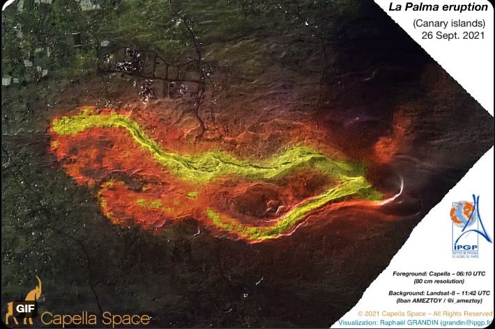
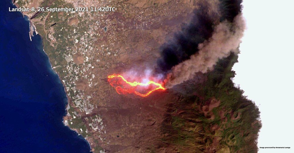
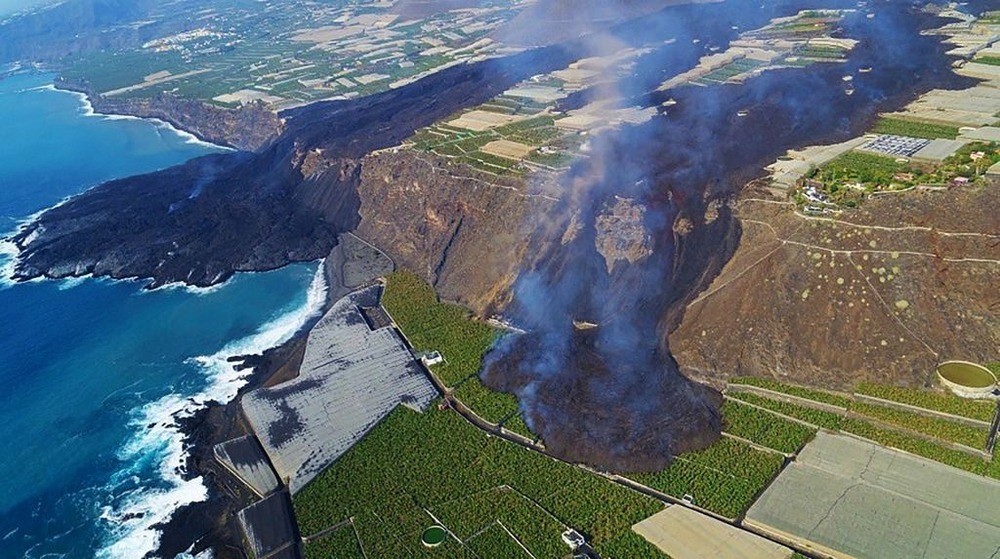
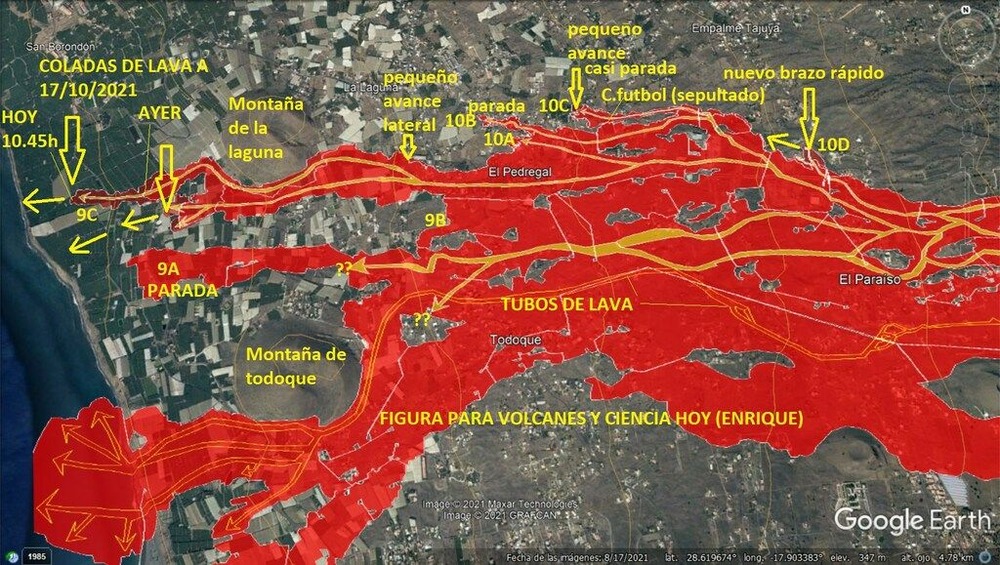
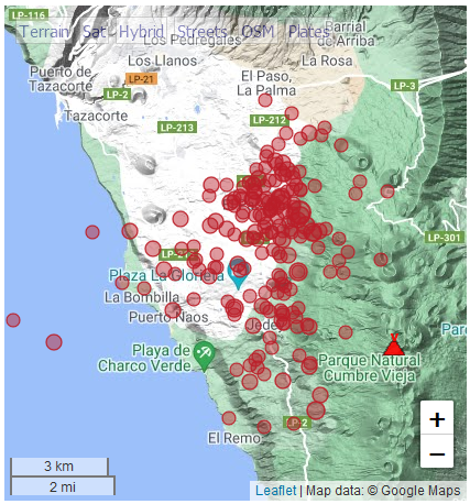
Earthquakes in last 48 hours are shown below. One lava flow is near El Paso at the top of the image.
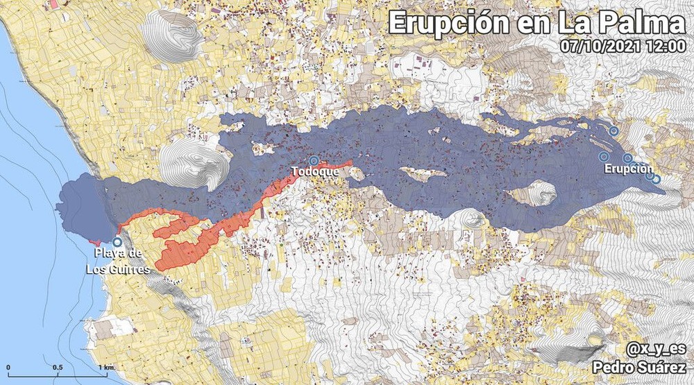
The area of land that participated in the the landslide shown in the image above is the entire frame of the image below, from north of Tazacorte to south of El Remo
https://www.reuters.com/world/europe/thousands-flee-lava-spewing-volcano-spains-la-palma-island-destroys-houses-2021-09-20/
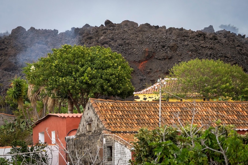
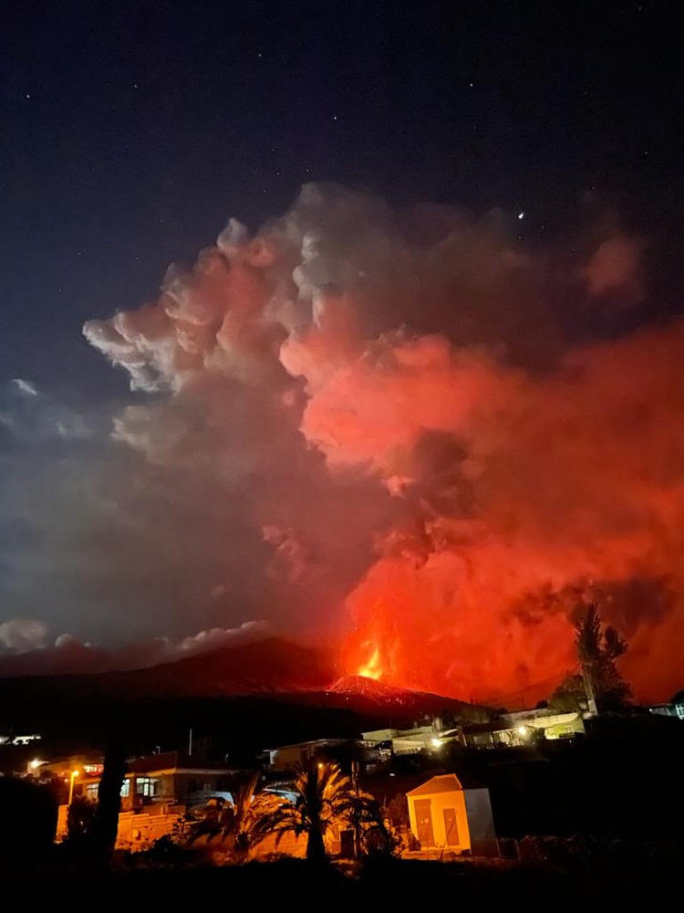
From latest news report: “Some 100 houses destroyed, no fatalities. Island still open to tourism, minister says”.
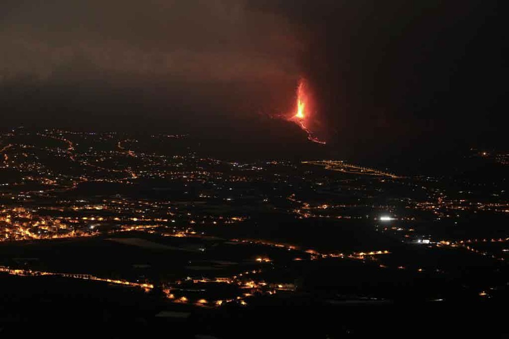
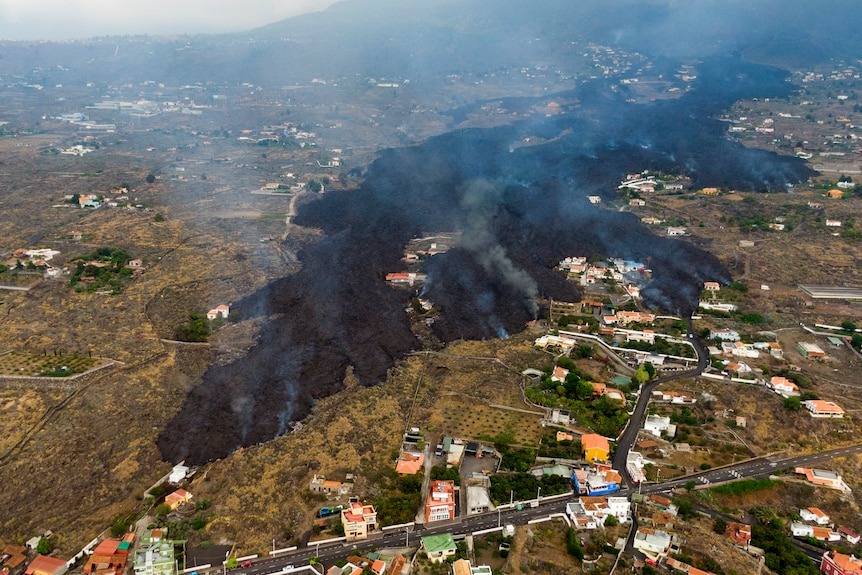
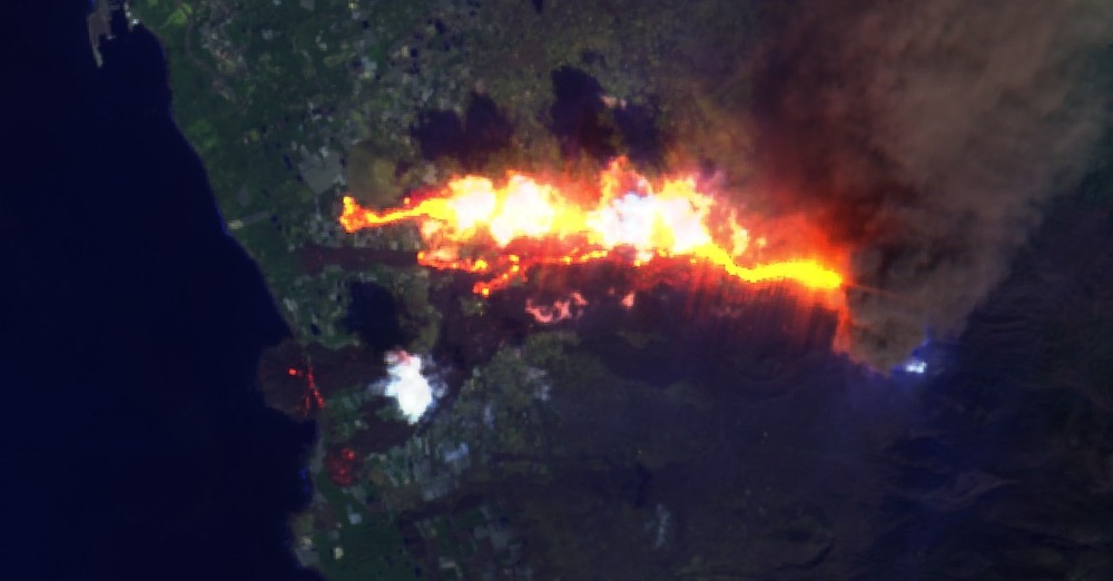
“drone footage captured two tongues of black lava cutting a devastating swathe through the landscape as they advanced down the volcano’s western flank towards the sea. … saw the flow of molten rock slowly tear its way through a house in the village of Los Campitos … Los Llanos de Aridane … Emergency services said it was unclear what path the lava would take to the ocean. Authorities had evacuated people with mobility issues from several coastal towns, including the Puerto Naos resort. … Airspace around the Canaries remained open with no visibility problems.”
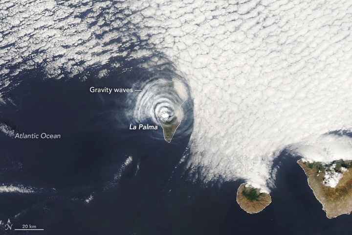
The relative lack of volcanic dust is good(?) news for the telescopes. The observatory on La Palma should be considered the third most important astronomical observatory on the planet. Only Mauna Loa on Hawaii and Paranal in Chile are more important.
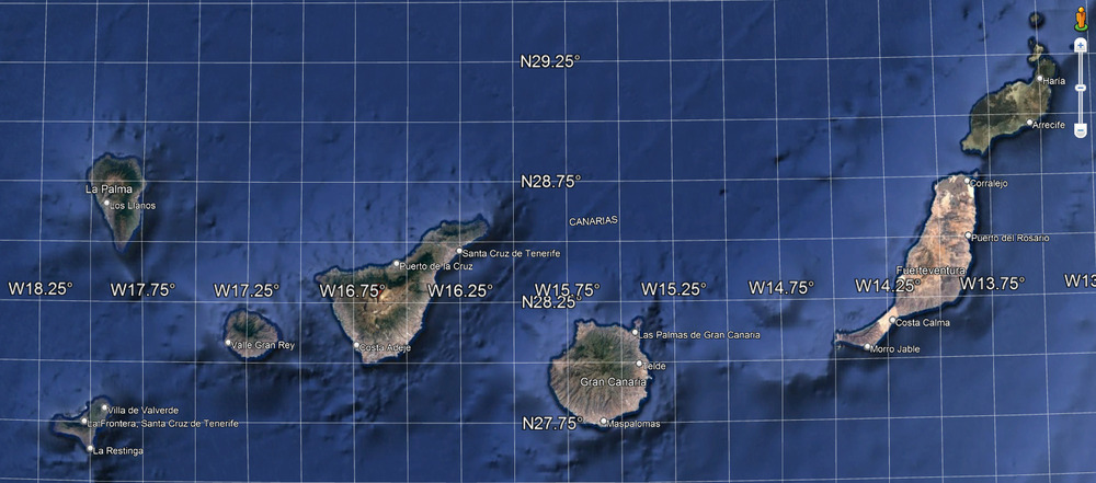
Where’s Los Campitos and Los Llanos de Aridane? El Paraiso area, well south of El Paso. 4 km further away from the main Observatory. At the same latitude as and directly below the small observatory Mirador Astronómico del Llano del Jable.
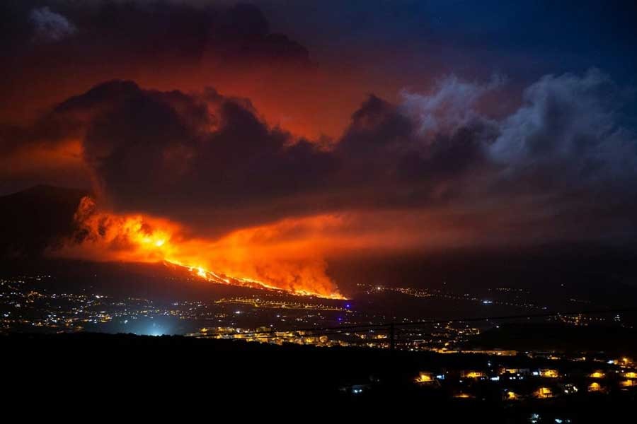
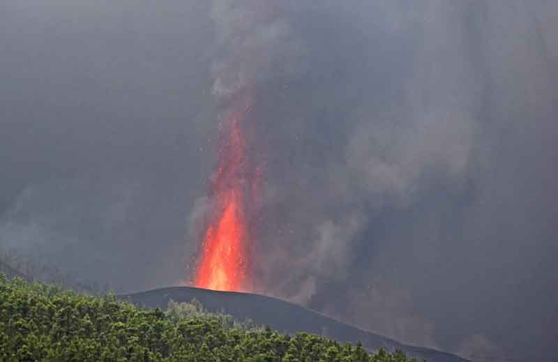
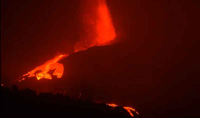
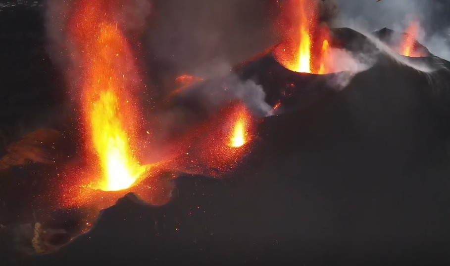
“An impressive time-lapse video has been posted by the astrophysical observatory Instituto de Astrofísica de Canarias of the first day of the La Cumbre Vieja volcano’s eruption. Lava jets surpassed up to a few 100 m height.” The wind is blowing the right way, thankfully, away from the observatory. So, not at major risk yet.
https://twitter.com/i/status/1439719095876849666