Date: 23/01/2022 20:08:25
From: monkey skipper
ID: 1839802
Subject: Megaberg' Released 152 Billion Tons of Freshwater

Antarctic ‘Megaberg’ Released 152 Billion Tons of Freshwater Just Before Melting
David Nield 1 day ago

Scientists have been keeping a close eye on the ‘megaberg’ designated as A68a since it split off from Antarctica back in July 2017 – and new research highlights just how much freshwater it’s released into the ocean during its late melting process.

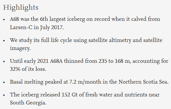
Satellite monitoring systems indicate that for three months at the end of its lifetime, up to March 2021, the iceberg released an astonishing 152 billion tons of freshwater around the remote island of South Georgia – that’s the equivalent of 61 million Olympic-sized swimming pools.

There are worries about how this sudden injection of freshwater and the nutrients flowing off the iceberg could affect marine habitats around the island in terms of both ocean circulation and the biological food chain.

“This is a huge amount of meltwater, and the next thing we want to learn is whether it had a positive or negative impact on the ecosystem around South Georgia,” says Anne Braakmann-Folgmann, a glaciologist from the University of Leeds in the UK and the study’s lead author.

A total of five satellites were employed to keep tabs on the position, area, thickness, and volume change of A68a. At its peak, the iceberg was melting at a rate of 7 meters or 23 feet per month.

https://youtu.be/W-3E6HTh1j8

Drifting icebergs can affect the patterns of the ocean, block routes used by wildlife, and leave damaging plow marks on the seafloor. It looks as though A68a broke up early enough to avoid scraping the seafloor, though the sheer amount of freshwater released could still be a problem.

A more direct hit on South Georgia – home to millions of penguins, seals, and other marine animals – was narrowly avoided. However, researchers are still keen to investigate the ongoing impacts of A68a now that it has finally disappeared.

“Because A68A took a common route across the Drake Passage, we hope to learn more about icebergs taking a similar trajectory and how they influence the polar oceans,” says Braakmann-Folgmann.

A68a eventually traveled for three-and-a-half years and covered a distance of 4,000 kilometers (2,485 miles) before melting away into nothing by April last year. Some smaller, ‘child’ icebergs broke off over time, designated as A68b, A68c, and so on.

At the beginning of its trip, A68a was the sixth-largest iceberg ever recorded on satellite, with a surface area of 5,719 square kilometers (2,208 square miles). When it carved away into the sea, it reduced the size of the Larsen C ice shelf by nearly 12 percent.

As time has gone on, we’ve seen the iceberg battered by winds and waves, and by charting its slow disintegration so closely, scientists now have a better idea of how other icebergs might behave in the open ocean in the future.

“A68a was an absolutely fascinating iceberg to track all the way from its creation to its end,” says Laura Gerrish, a specialist in mapping and geographic information systems from the British Antarctic Survey (BAS).

“Frequent measurements allowed us to follow every move and break-up of the berg as it moved slowly northwards through iceberg alley and into the Scotia Sea where it then gained speed and approached the island of South Georgia very closely
Reply Quote

Date: 25/01/2022 19:04:25
From: mollwollfumble
ID: 1840575
Subject: re: Megaberg' Released 152 Billion Tons of Freshwater

> Antarctic ‘Megaberg’ Released 152 Billion Tons of Freshwater Just Before Melting

What a waste. We could have used that. ;-)

> the next thing we want to learn is whether it had a positive or negative impact on the ecosystem around South Georgia

Excellent.

My guess would be that sub-antarctic islands are used to being host to melting icebergs.

If it has a negative effect, then people will say “we have to stop this”.
If it has a positive effect, people will say “with global warming there will be fewer events like these”.

> A more direct hit on South Georgia – home to millions of penguins, seals, and other marine animals – was narrowly avoided.

In that case, a little more global warming would help.

> A68a was an absolutely fascinating iceberg to track all the way from its creation to its end. Frequent measurements allowed us to follow every move and break-up of the berg

Al the way? Less than two years ago I happened to notice while looking at the Brunt Ice Shelf that spacecraft can’t track icebers during the 24 hour darkness of winter. Perhaps they can now, but if so then I don’t know which spacecraft it is.

Do you know?

Reply Quote

Date: 28/01/2022 05:17:00
From: mollwollfumble
ID: 1841365
Subject: re: Megaberg' Released 152 Billion Tons of Freshwater

I’ve found a technical article, free to view.

Observing the disintegration of the A68A iceberg from apace

https://www.sciencedirect.com/science/article/pii/S0034425721005757

> We track the iceberg’s area and area change in satellite imagery. In total, 23 Sentinel-1, 18 Moderate Resolution Imaging Spectroradiometer (MODIS) and 14 Sentinel-3 scenes are used to manually delineate the iceberg’s outlines using GIS software. While the Sentinel-1 Synthetic Aperture Radar (SAR) imagery offers all-weather capability and higher spatial resolution, MODIS and Sentinel-3 optical imagery have the advantage of a higher temporal resolution, but cannot be used during the polar night and on cloudy days.

Aha, I knew of the limitations of MODIS, doesn’t work at night. I didn’t know of Sentinal-1 synthetic aperture radar.

> Changes in the iceberg’s freeboard and thickness are derived from CryoSat-2 and ICESat-2 satellite altimetry. To generate a complete map of the initial iceberg freeboard and thickness, we collect all CryoSat-2 tracks over the part of the Larsen-C Ice Shelf that formed the A68A iceberg between 12 July 2016 and 11 July 2017 (Fig. 2). To track changes in the iceberg freeboard while it is drifting, we colocate 15 overpasses from ICESat-2 and 9 overpasses.

Aha, I’ve been trying to get data from ICESat-2, unsuccessfully so far. But they are able to use ICESat-2 ONLY because they use the raw datra (overfly on predetermined track), whereas I’m looking for gridded altitude data, which didn’t exist the last two times I looked.

Now checking ICESSat-2 data products https://icesat-2.gsfc.nasa.gov/science/data-products . Nope, data product ALT14 still doesn’t exist :-(

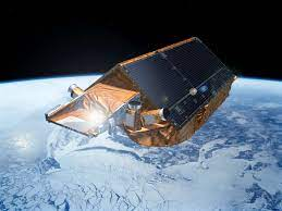
I don’t know CryoSat-2. Check web. An excellent overview of CryoSat-2 is at https://earth.esa.int/web/eoportal/satellite-missions/c-missions/cryosat-2 Note that it’s ESA not NASA.

The following image shows the decreasing thickness of the berg from July 2017 to Jan 2021.

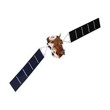
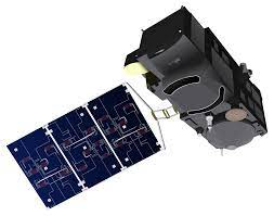
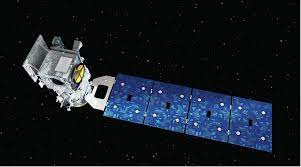
The satellites:
Sentinel-1

Sentinel-3

Cryosat-2

ICEsat-2

Reply Quote