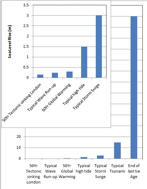
As climate change continues to progress, so will its effects. In a new collaborative report, NASA and other U.S. government agencies have found that sea levels will rise up to a foot by 2050.
The report, which comes from a sea level rise task force that includes a number of government agencies including NASA as well as the National Oceanic and Atmospheric Administration (NOAA), has concluded that sea levels along U.S. coastlines will, on average, rise between 10 and 12 inches (25 to 30 centimeters) above today’s levels by 2050. This means that, in just 30 years, ocean height could rise as much as it has risen in the past 100 years.
This new report includes “the most up-to-date, long term sea level rise projections for all of the United States and Territories,” NOAA Administrator Rich Spinrad said during a news conference Tuesday (Feb. 15), adding that “what we’re reporting out today is historic.”
More:
https://www.livescience.com/historic-sea-level-rise-predicted-nasa