The best preserved ancient habitation sites in Australia tend to be in arid areas, though there are a couple of sites in North Qld auch as Ngarrabullgan Cave.
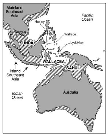
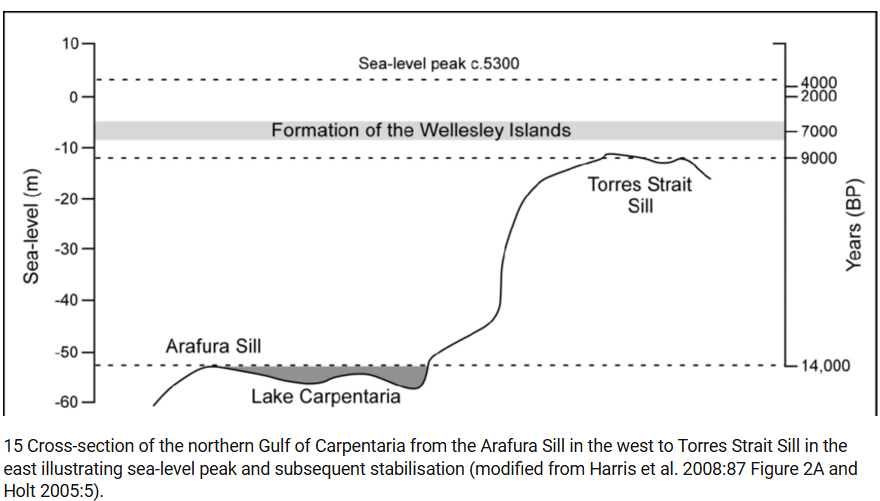
OTOH the earliest settlement sites in the Sahul* are not available to us because of sumersion. Since the arrival of humans on this side of the Wallace line, the sea level has risen 60 to 70 metres (depending on exactly when the event occurred).
I’ve often thought about this huge territory that at one time was inhabited by hundreds of thousands of people. I hope that one day we know as much about this lost country as we do about, for instance, Doggerland in the North Sea.
The land bridge between Australia and New Guinea closed around 12000 years ago.
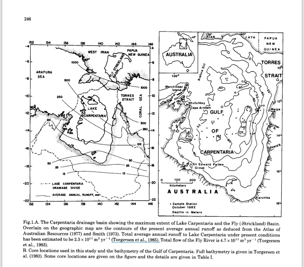
One thing that the Sahul had in this period that Australia lacks now is a large freshwater lake. In the 1980s, dozens of cores were extracted from what is now the Gulf of Carpentaria, supported by a seismic imaging program, enabling a detailed map of the ancient shoreline of Lake Carpentaria. This broad but shallow lake existed from around 35000 to 12000 years ago, and drained towards the west across a sill that is now 53 metres below sea level. At times it was brackish but the fossils recovered indicate that it was fresh for at least 15000 years. I do wonder about whether the people of that time and place, ancestors of modern Aboriginals and Papuans, were able to make good use of the lake: its shore does suggest itself as a good place to set up camp.
Late Quarternary Environments of the Carpentaria Basin, Australia by T Torgersen
dazvoz.com/Late_quarternary_environments_of_the_Carp.pdf
*Sahul=the former land mass formed of Australia, Tasmania, New Guinea, Aru Islands, and the shallow shelf around them.