NASA’s Terra satellite captured an image of the snow-covered eastern U.S. that looks like the states have been sitting in a freezer. In addition to the snow cover, Arctic and Siberian air masses have settled in over the Eastern U.S. triggering many record low temperatures in many states.
http://wattsupwiththat.com/2015/02/21/eastern-u-s-record-breaking-cold-and-snow-as-seen-from-space/
On Feb. 19 at 16:40 UTC (11:40 a.m. EST), the Moderate Resolution Imaging Spectroradiometer (MODIS) instrument that flies aboard NASA’s Terra satellite captured a picture of the snowy landscape. The snow cover combined with the frosty air mass made the eastern U.S. feel like the inside of freezer. The MODIS image was created at NASA’s Goddard Space Flight Center in Greenbelt, Maryland.
http://wattsupwiththat.com/2015/02/21/eastern-u-s-record-breaking-cold-and-snow-as-seen-from-space/

Great Lakes Rapidly Freezing Over
February 19th, 2015. http://www.drroyspencer.com/2015/02/great-lakes-rapidly-freezing-over/
The recent frigid weather has led to a rapid freezing cycle on the Great Lakes, with ice cover increasing by another 20% in the last 10 days, which makes it now equal to last year’s epic coverage by this date.
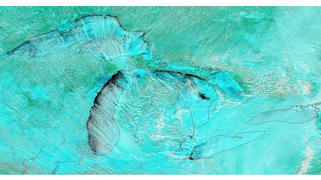
forecast temperatures for the next 10 days over the Great Lakes will be running an average of 15-20 deg. F below normal, so we could be looking at another record-setting ice cover season
